Mohomap
Författare/Upphovsman:
Tillskrivning:
Bilden är taggad "Attribution Required" men ingen tillskrivningsinformation lämnades. Attributionsparametern utelämnades troligen när MediaWiki-mallen användes för CC-BY-licenserna. Författare och upphovsmän hittar ett exempel för korrekt användning av mallarna här.
Kreditera:
Eget arbete
Kort länk:
Källa:
Upplösning:
3282 x 1821 Pixel (278285 Bytes)
Beskrivning:
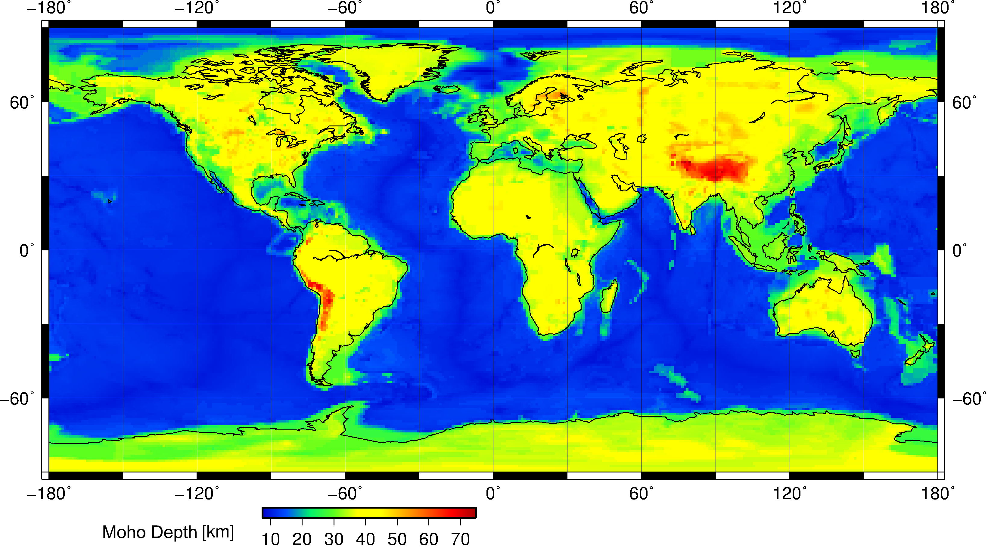
This is a geophysical map showing the position of the Moho discontinuity across the Earth. The Moho is the boundary between the Earth's crust and the mantle. Search "Mohorovičić discontinuity" for more information.
This map was constructed using the Crust 1.0 model and Generic Mapping Tools (GMT) for Linux. It was done at the Christian-Albrechts University of Kiel, Germany.
Licens:
Licensvillkor:
Creative Commons Attribution-Share Alike 3.0
Mer information om licensen för bilden finns här. Senaste uppdateringen: Fri, 27 Sep 2024 20:16:40 GMT