Mare Boreum Map
Författare/Upphovsman:
Jim Secosky (Jimmarsmars at en.wikipedia) modified NASA photo (U.S. Geological survey).
Kort länk:
Källa:
Upplösning:
479 x 478 Pixel (35755 Bytes)
Beskrivning:
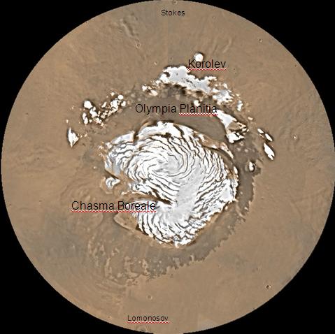
Map of Mare Boreum Mars quadrangle. The small, colored rectangles represent image footprints for the narrow angle camera on the Mars Global Surveyor. Some are about 1 mile wide, the otheers are about 2 miles wide.
Licens:
Public domain
Mer information om licensen för bilden finns här. Senaste uppdateringen: Mon, 27 Jan 2025 07:34:54 GMT