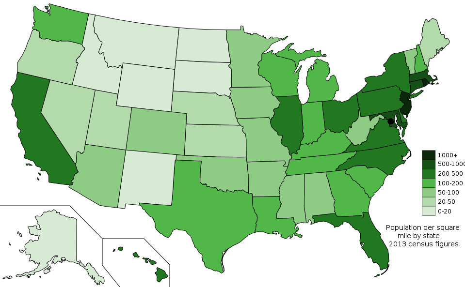
Map of states showing population density in 2013
Författare/Upphovsman:
Kreditera:
Eget arbete; Map is based on here.
Kort länk:
Källa:
Upplösning:
959 x 593 Pixel (51340 Bytes)
Beskrivning:
The US states with population density shown by people per square mile from the 2013 census, based on data from USCB.
Licens:
Licensvillkor:
Creative Commons Zero, Public Domain Dedication
Mer information om licensen för bilden finns här. Senaste uppdateringen: Tue, 21 Jan 2025 19:40:31 GMT
