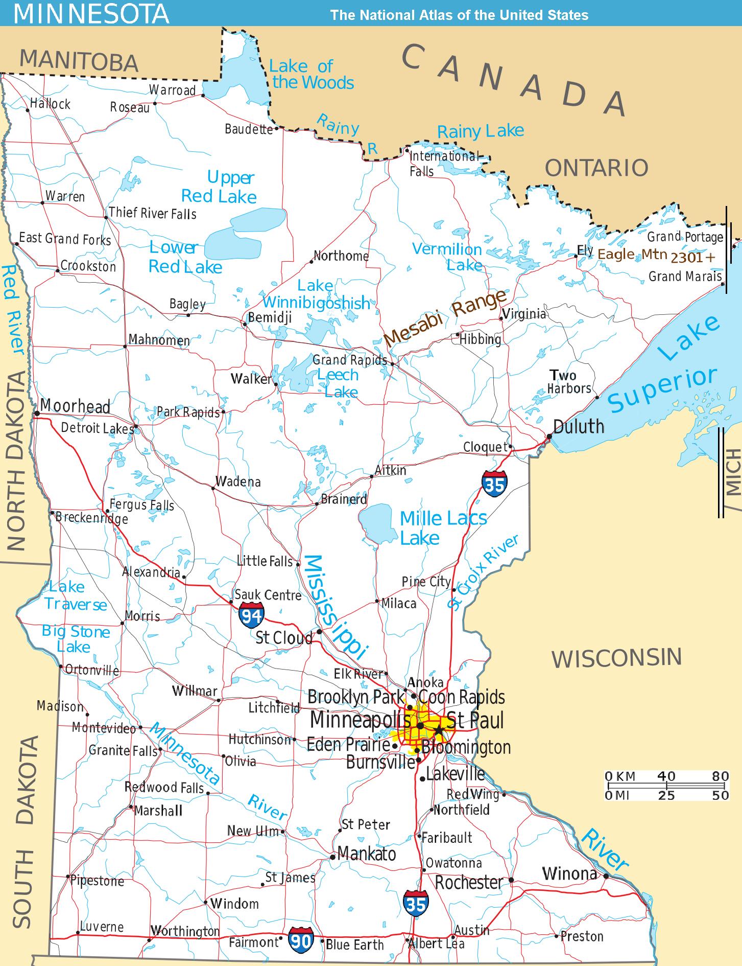
Map of Minnesota NA
Författare/Upphovsman:
Kreditera:
National Atlas (cropped to extract terrain only, no legend, with several names enlarged/added)
Kort länk:
Källa:
Upplösning:
1453 x 1890 Pixel (442863 Bytes)
Beskrivning:
Scalable map of the U.S. state of Minnesota, showing terrain features: hills, lakes, rivers, roads and major towns, in quick photographic format (JPEG) to highlight terrain features. The Mesabi Range, Mount Eagle, and nearby states are labeled; the Interstate icons are enlarged 40%; and major cities are bolded 20%-40% for readability when scaled to 310px display width. The distance scale is shown in miles/kilometers, and labels appear 4x times larger than original in the US National Atlas, at similar display width.
Format: Quick JPEG format for photographic quality, extracted/reduced from National-Atlas file of PNG format, 130x times more massive. Names have been enlarged for readability when map is resized smaller. Map is huge and could be reduced more: the original PNG file might crash browsers with many open windows.
Licens:
Public domain
Mer information om licensen för bilden finns här. Senaste uppdateringen: Wed, 29 Jan 2025 18:41:20 GMT