Map Gaels Brythons Picts
Författare/Upphovsman:
Tillskrivning:
Bilden är taggad "Attribution Required" men ingen tillskrivningsinformation lämnades. Attributionsparametern utelämnades troligen när MediaWiki-mallen användes för CC-BY-licenserna. Författare och upphovsmän hittar ett exempel för korrekt användning av mallarna här.
Kreditera:
Own work, based on File:Uk map home nations.png
Kort länk:
Källa:
Upplösning:
643 x 829 Pixel (67122 Bytes)
Beskrivning:
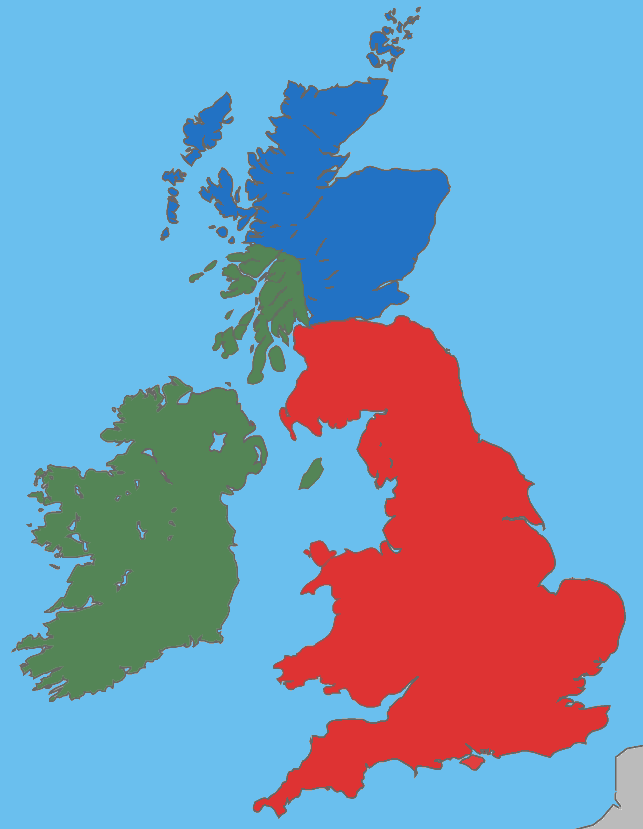
A map showing the approximate areas where the Gaelic (green), Brythonic (red) and Pictish (blue) languages were spoken during the 5th century CE; the period between the Roman withdrawal and the founding of Anglo-Saxon kingdoms.
Licens:
Licensvillkor:
Creative Commons Attribution-Share Alike 4.0
Mer information om licensen för bilden finns här. Senaste uppdateringen: Sat, 02 Mar 2024 20:52:56 GMT