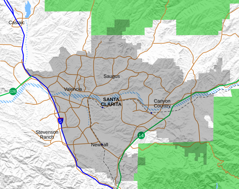
Location map Santa Clarita
Författare/Upphovsman:
Tillskrivning:
Bilden är taggad "Attribution Required" men ingen tillskrivningsinformation lämnades. Attributionsparametern utelämnades troligen när MediaWiki-mallen användes för CC-BY-licenserna. Författare och upphovsmän hittar ett exempel för korrekt användning av mallarna här.
Kreditera:
Kort länk:
Källa:
Upplösning:
796 x 627 Pixel (1982563 Bytes)
Beskrivning:
Location map for the Santa Clarita Valley in southern California. The scope of the map includes the entire city of Santa Clarita, as well as the nearby unincorporated communities of Stevenson Ranch and part of Castaic.
- North boundary: 34.5145°N
- South boundary: 34.3375°N
- West boundary: 118.6414°W
- East boundary: 118.3691°W
Legend:
Interstate 5
California State Routes (14 and 126)
Major surface streets
Metrolink rail line
Metrolink station (blue boxes)
Santa Clarita city limit (as of 2021)
Permanent bodies of water
Intermittent bodies of water (Santa Clara River and tributaries)
Angeles National Forest
Licens:
Licensvillkor:
Creative Commons Attribution-Share Alike 4.0
Mer information om licensen för bilden finns här. Senaste uppdateringen: Mon, 03 Feb 2025 18:17:35 GMT
