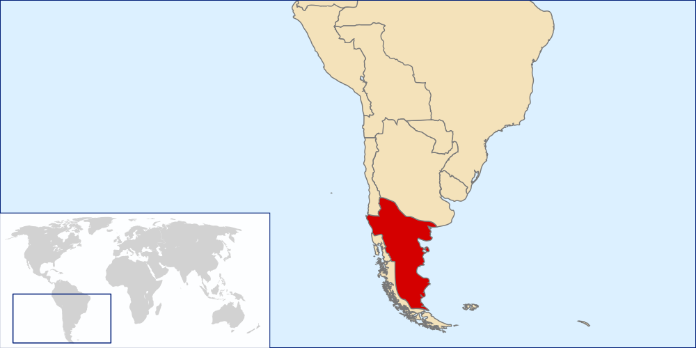
LocationKingdomAraucania
Författare/Upphovsman:
Tillskrivning:
Bilden är taggad "Attribution Required" men ingen tillskrivningsinformation lämnades. Attributionsparametern utelämnades troligen när MediaWiki-mallen användes för CC-BY-licenserna. Författare och upphovsmän hittar ett exempel för korrekt användning av mallarna här.
Kreditera:
self-made based in Image:LocationChile.svg and Image:Continents.svg
Kort länk:
Källa:
Upplösning:
1000 x 500 Pixel (1010274 Bytes)
Beskrivning:
Locator map of the Kingdom of Araucania and Patagonia (approx. 1860-1862).
The map shows only an idea of the territory disputed by the unrecognized Kingdom because there isn't any exact definition of it. Also the historical frontiers of other countries aren't accurate.
The zone of Aysen, Magallanes and Tierra del Fuego islands are shown as a separate entity because it was disputed by Chile and Argentina at the time. Most of Western Patagonia (also disputed by both countries) are shown as a territory of the Kingdom.
Licens:
Licensvillkor:
Creative Commons Attribution-Share Alike 4.0
Mer information om licensen för bilden finns här. Senaste uppdateringen: Thu, 16 Mar 2023 06:24:20 GMT
