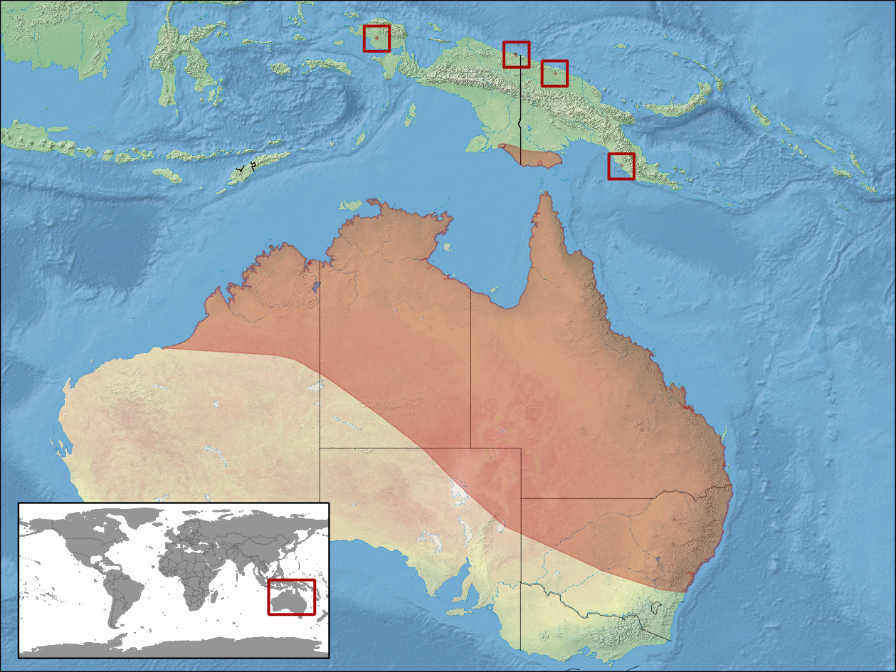
Litoria caerulea distribution
Författare/Upphovsman:
- compiled by rbrausse with Quantum GIS
- Map data: Made with Natural Earth. Free vector and raster map data @ naturalearthdata.com.
- Range data: Jean-Marc Hero, Stephen Richards, Richard Retallick, Paul Horner, John Clarke, Ed Meyer 2004. Litoria caerulea. In: IUCN 2013. IUCN Red List of Threatened Species. Version 2013.1. <www.iucnredlist.org>. Downloaded on 03 November 2013.
Kreditera:
Eget arbete baserat på: http://www.naturalearthdata.com/downloads/ (downloaded Oct. 2012) and https://s3-eu-west-1.amazonaws.com/spatial-data/groups/AMPHANURA.zip (downloaded Oct. 2013)
Kort länk:
Källa:
Upplösning:
1259 x 944 Pixel (2021249 Bytes)
Beskrivning:
Geographic distribution of Litoria caerulea (Native:
Australia; Indonesia; Papua New Guinea)
Licens:
Licenskommentaren:
The use of spatial data from the IUCN Red List web site to produce species distribution maps is subject to the Attribution-Share Alike Creative Commons License. In short: you are free to distribute and modify the file as long as you attribute its authors and the IUCN Red List.
Licensvillkor:
Creative Commons Attribution-Share Alike 3.0
Mer information om licensen för bilden finns här. Senaste uppdateringen: Tue, 03 Sep 2024 04:42:04 GMT