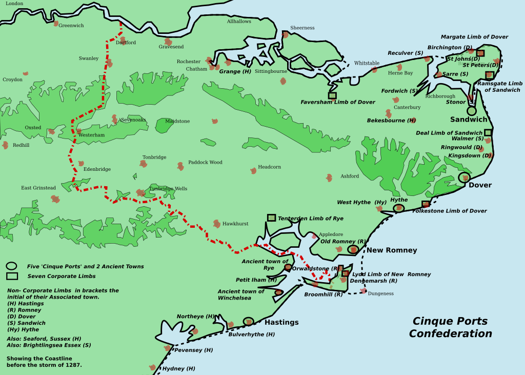
Kent Cinque Ports
Författare/Upphovsman:
Tillskrivning:
Bilden är taggad "Attribution Required" men ingen tillskrivningsinformation lämnades. Attributionsparametern utelämnades troligen när MediaWiki-mallen användes för CC-BY-licenserna. Författare och upphovsmän hittar ett exempel för korrekt användning av mallarna här.
Kreditera:
Eget arbete
Kort länk:
Källa:
Upplösning:
1700 x 1212 Pixel (166524 Bytes)
Beskrivning:
This ia a map of the Cinque Ports in Kent and Sussex. All seven of them and their 7 limbs and many of the associated limbs. In 1287, the storm caused the silting up of the channel of the River Rother. The map was inspired by Jessop, Kent History Illustrated- please contact me to inform me of omissions and errors.
Licens:
Licensvillkor:
Creative Commons Attribution 2.5
Mer information om licensen för bilden finns här. Senaste uppdateringen: Mon, 16 Sep 2024 06:45:39 GMT
