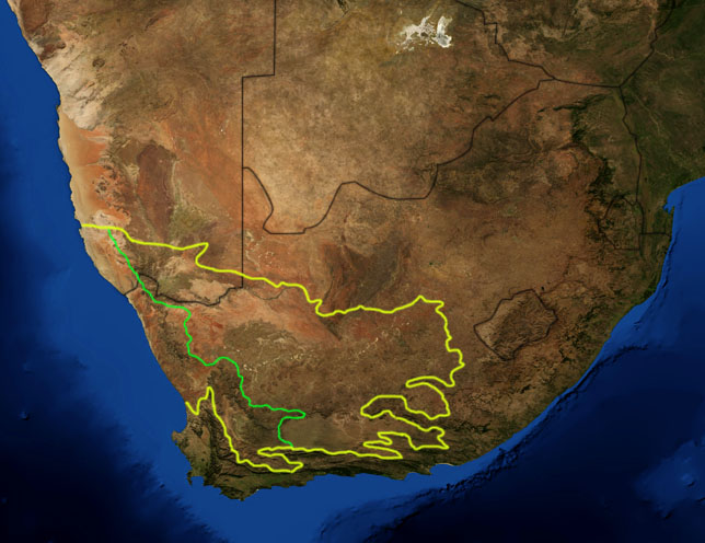
Karoo ecoregion
Författare/Upphovsman:
Pfly
Kreditera:
NASA, plus my additions by myself.
Kort länk:
Källa:
Upplösning:
644 x 496 Pixel (117049 Bytes)
Beskrivning:
This is a map showing the location of the two Karoo ecoregions of southern Africa, as delineated by the World Wide Fund for Nature. The yellow line encloses the two ecoregions. The green line separates the Succulent Karoo, on the west, from the Nama Karoo, on the east. National boundaries are shown in black. I, Pfly, made it using NASA Blue Marble imagery and ecoregion GIS data which I simplified and digitized in Photoshop.
Licens:
Public domain
Mer information om licensen för bilden finns här. Senaste uppdateringen: Wed, 07 Aug 2024 03:41:19 GMT