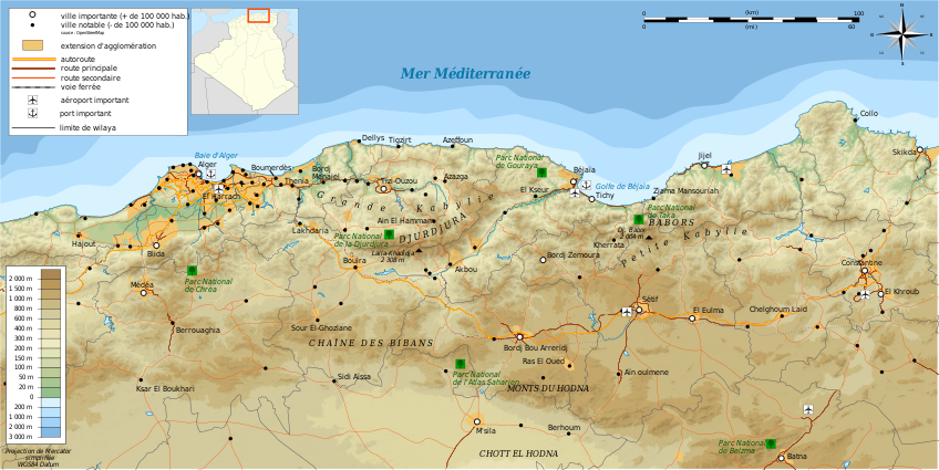
Kabylie topographic map-fr
Författare/Upphovsman:
Tillskrivning:
Bilden är taggad "Attribution Required" men ingen tillskrivningsinformation lämnades. Attributionsparametern utelämnades troligen när MediaWiki-mallen användes för CC-BY-licenserna. Författare och upphovsmän hittar ett exempel för korrekt användning av mallarna här.
Kreditera:
Création personnelle ;
- Topographie : NASA Shuttle Radar Topography Mission (SRTM3 v.2) (domaine public) ;
- Bathymétrie : ETOPO1 de la National Geophysisal Data Center ;
- River, coast, lakes, places, transportation, boundaries / Cours d'eau, côtes, récifs, extension d'agglomération et villes, transports, frontières : données de la carte © les contributeurs d'OpenStreetMap, CC-BY-SA Openstreetmap ;
- Urban area : NaturalEarth ;
- Locator map / Carte de situation dérivée de File:Algeria location map.svg
- Others sources / sources diverses (pour certains noms) : le petit futé Algérie 2011, carte pp. 288-289.
- Other symbols / autres symboles provenant de File:Maps template-fr.svg
- Software / logiciels utilisés (méthode décrite dans ce didacticiel) :
Kort länk:
Källa:
Upplösning:
848 x 425 Pixel (5226686 Bytes)
Beskrivning:
Topographic map in French language of Kabylie
Licens:
Licenskommentaren:
| Attribution and Share-Alike required |
|---|
| Any use of this image can be made as long as you credit me (Wikimedia Commons user: Bourrichon) as the author and distribute the copies and derivative works under the same license(s) that the one(s) stated below. A message with a reply address would also be greatly appreciated. |
Licensvillkor:
Creative Commons Attribution-Share Alike 3.0
Mer information om licensen för bilden finns här. Senaste uppdateringen: Sat, 16 Sep 2023 16:59:36 GMT
