KLEX USGS Comair Paths
Författare/Upphovsman:
Path data is approximate and was overlayed by Dual Freq on top of PD original.
Kreditera:
Extracted via USA Photomaps software
Kort länk:
Källa:
Upplösning:
3600 x 3900 Pixel (2538630 Bytes)
Beskrivning:
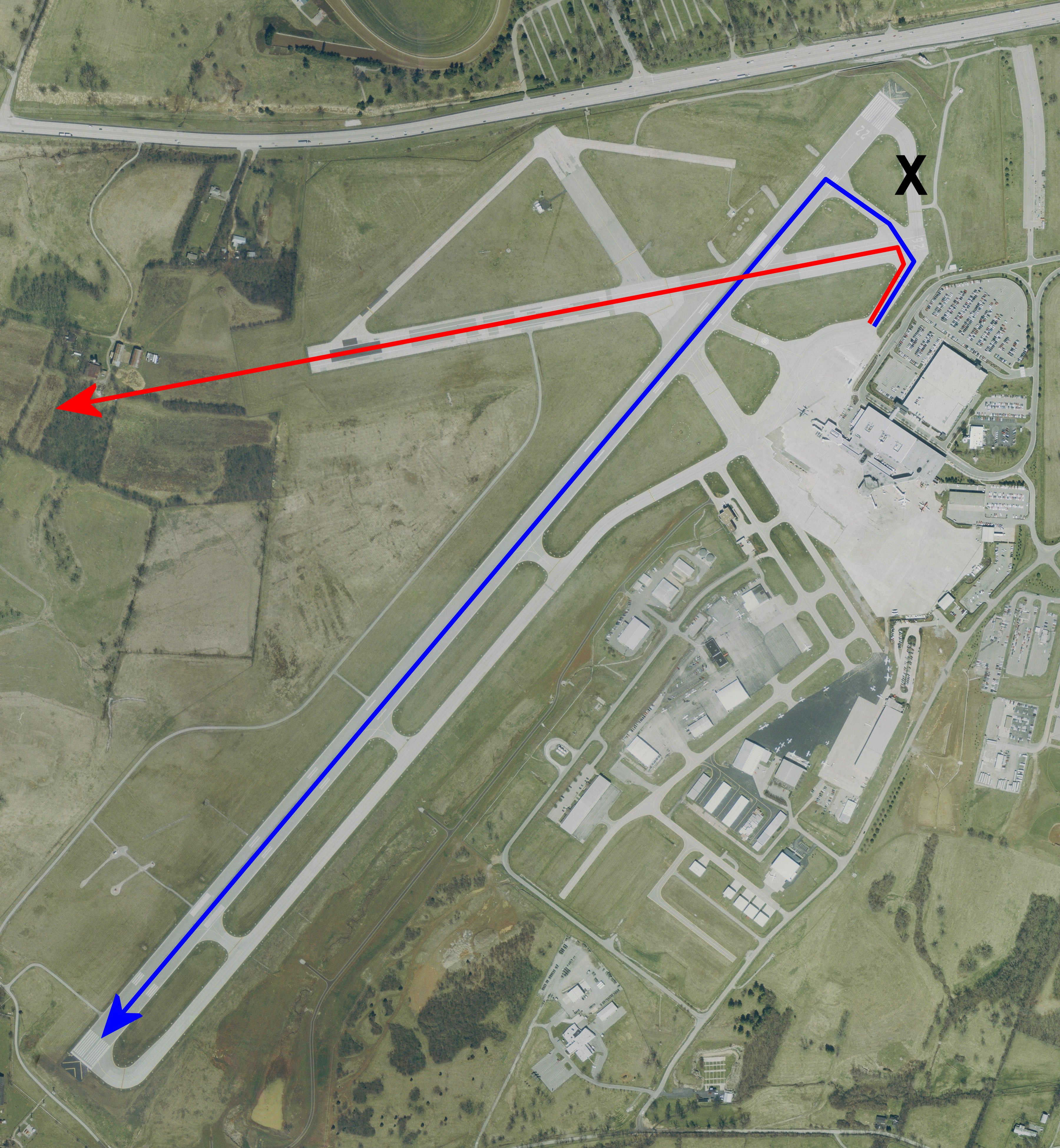
USGS urban ortho of Blue Grass Airport, Kentucky, USA. Overlayed with intended route vs actual route and approx crash site. X denotes the taxiway that was closed following recent construction.
Desired path via Rwy 22
Actual path via Rwy 26, ending at approximate crash site.
X marks the closed taxiway
Licens:
Public domain
Licenskommentaren:
This image is in the public domain in the United States because it only contains materials that originally came from the United States Geological Survey, an agency of the United States Department of the Interior. For more information, see the official USGS copyright policy.
Mer information om licensen för bilden finns här. Senaste uppdateringen: Wed, 08 Jan 2025 03:03:49 GMT