Juan de fuca plate
Författare/Upphovsman:
The Pacific Northwest Urban Corridor Geologic Mapping Project of the Western Earth Surface Processes Team, Geologic Division, U.S. Geological Survey
Kort länk:
Källa:
Upplösning:
536 x 652 Pixel (46902 Bytes)
Beskrivning:
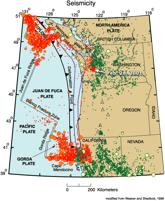
Map of the Juan de Fuca Plate.
Licens:
Public domain
Mer information om licensen för bilden finns här. Senaste uppdateringen: Mon, 29 Aug 2022 01:21:49 GMT