Hornstrandir og Jökulfirðir
Författare/Upphovsman:
Tillskrivning:
Bilden är taggad "Attribution Required" men ingen tillskrivningsinformation lämnades. Attributionsparametern utelämnades troligen när MediaWiki-mallen användes för CC-BY-licenserna. Författare och upphovsmän hittar ett exempel för korrekt användning av mallarna här.
Kreditera:
Eget arbete
Kort länk:
Källa:
Upplösning:
1649 x 1156 Pixel (283933 Bytes)
Beskrivning:
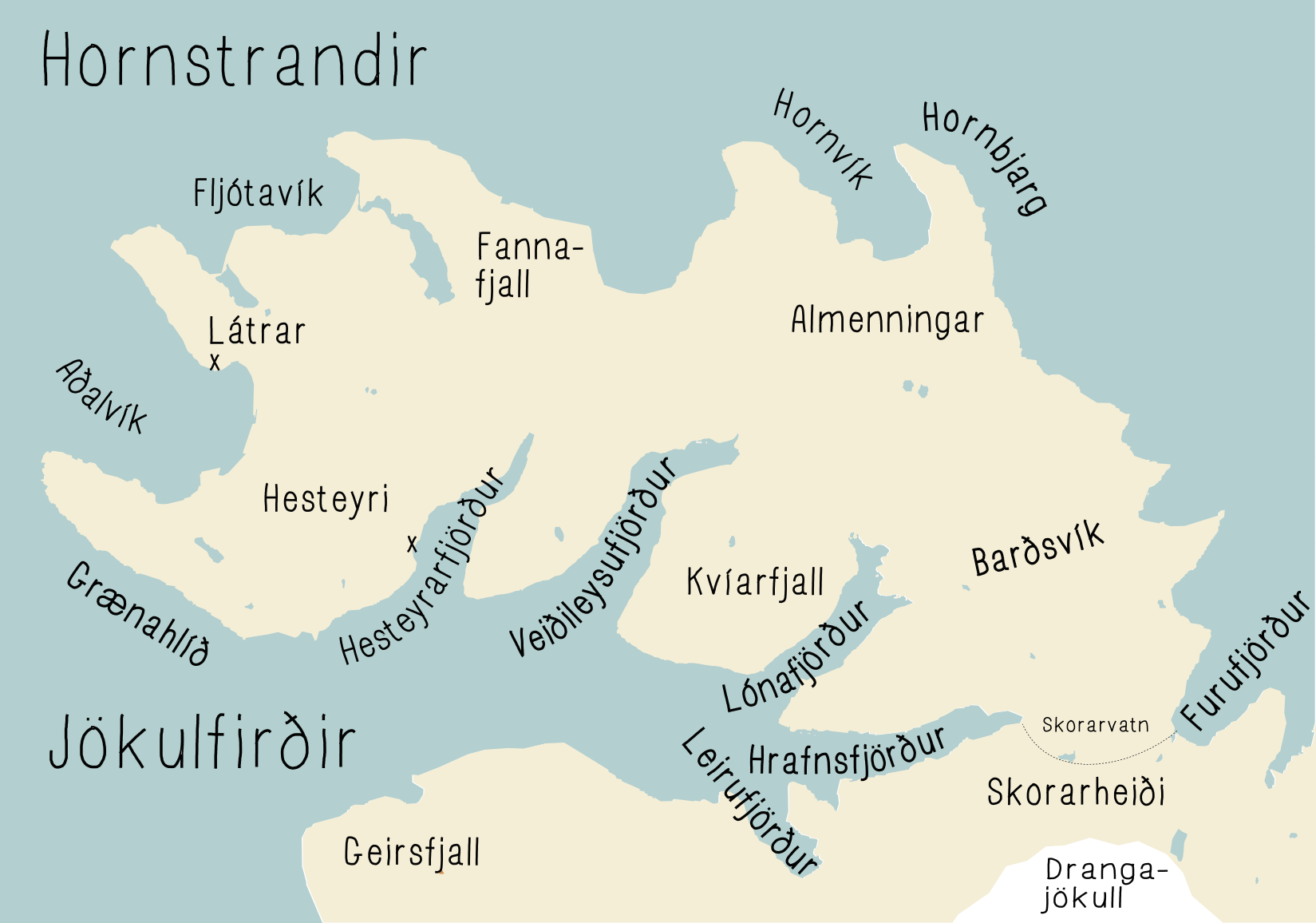
Map of Hornstrandir and Jökulfirðir (glacier fjords) nature reserve in Westfjords area in Iceland, showing location of the main fjords and the boundary of the natural reserve on Skorarheiði.
Svg version of this file File:Hornstrandir og jökulfirðir.svg
This map is drawn from a map from OpenStreetMap http://www.openstreetmap.org/ with CC-BY-SA licence https://creativecommons.org/licenses/by-sa/2.0/ and map from Iceland http://www.ust.is/library/Skrar/Einstaklingar/Fridlyst-svaedi/Auglysingar/Hornstrandir_kort.pdf
Licens:
Licensvillkor:
Creative Commons Attribution-Share Alike 3.0
Mer information om licensen för bilden finns här. Senaste uppdateringen: Fri, 11 Oct 2024 21:37:58 GMT