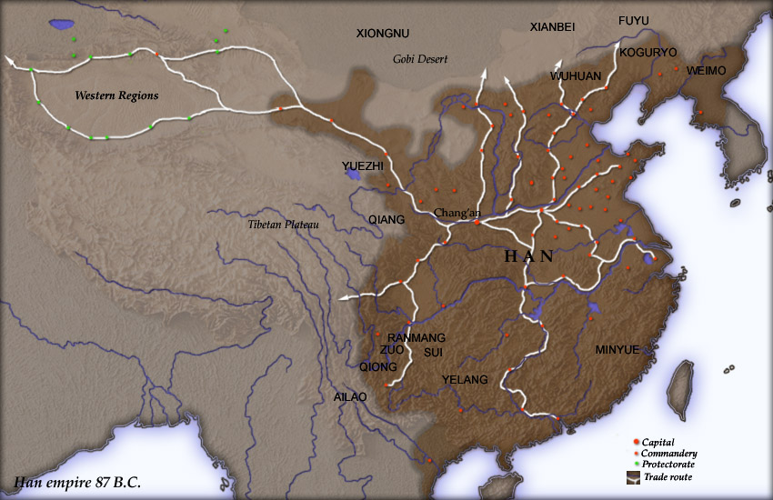
Han map
Författare/Upphovsman:
User Yuninjie on en.wikipedia
Tillskrivning:
Bilden är taggad "Attribution Required" men ingen tillskrivningsinformation lämnades. Attributionsparametern utelämnades troligen när MediaWiki-mallen användes för CC-BY-licenserna. Författare och upphovsmän hittar ett exempel för korrekt användning av mallarna här.
Kreditera:
Created and copyright (2004) by Yuninjie. Released under the GNU FDL. The northern border is the line of the en:Qin Dynasty en:Great Wall. Trade routes are generally based on the work of en:Joseph Needham. Selected non-Chinese peoples are also shown.
Kort länk:
Källa:
Upplösning:
850 x 550 Pixel (154737 Bytes)
Beskrivning:
Map of en:Han Dynasty empire 87 BC, showing the capital en:Chang'an and the location of all en:commandery seats. In the Western Regions, a number of pretectorates were Han vassals and under the nominal authority of the Chief Protector of the Western Regions appointed by the Han court.
en:Category:Maps of the history of China
Licens:
Licenskommentaren:
Released under the GNU Free Documentation License.
Licensvillkor:
Creative Commons Attribution-Share Alike 3.0
Mer information om licensen för bilden finns här. Senaste uppdateringen: Fri, 05 Jul 2024 18:39:57 GMT
