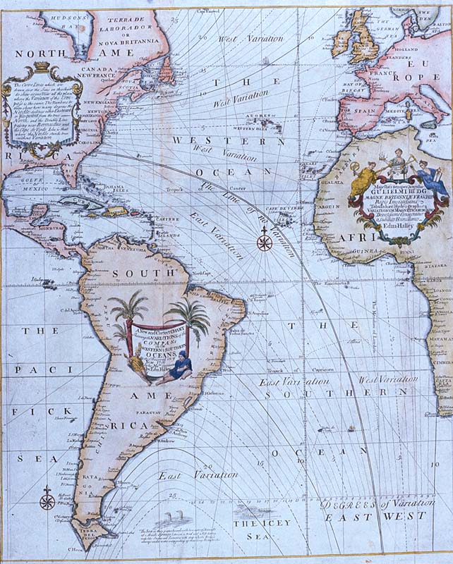
Halley compass variations 1702
Författare/Upphovsman:
Edmond Halley
Kreditera:
Plate 22 from Mount & Page's 1702 "Atlas Maritimus Novus, or the New Sea-Atlas."
This image was found at [1], in the online map database of the Louisiana State Museum, accession number 1982.077.020
![[1]](http://lsm.crt.state.la.us/lsmmaps/jpegs/1982.077.020.jpg)
Kort länk:
Källa:
Upplösning:
642 x 800 Pixel (153711 Bytes)
Beskrivning:
Edmond Halley's New and Correct Chart Shewing the Variations of the Compass (1701), the first chart to show lines of equal magnetic variation.
See also exhibit G201:1/1 at the UK National Maritime Museum. The NMM scan may however be protected by copyright in the UK.
Licens:
Public domain
Mer information om licensen för bilden finns här. Senaste uppdateringen: Wed, 31 Jan 2024 03:01:15 GMT