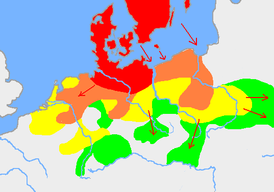
Germanic tribes (750BC-1AD)
Författare/Upphovsman:
Kreditera:
Överförd från en.wikipedia till Commons.
Kort länk:
Källa:
.png?uselang=sv)
Upplösning:
537 x 376 Pixel (10501 Bytes)
Beskrivning:
Based on p. 108 in the Penguin Atlas of World History, volume 1, from the Beginning to the Eve of the French Revolution. 1988. ISBN 0-14-051054-0. Note that the map assumes that the Nordwestblock was Germanized before 500 BC. This is uncertain; alternative proposals hold that the area near the mouths of the Rhine came under a Germanic superstate only in the 1st century BC.
The map is drawn on en:User:Dbachmann's blank map: en:Image:Europe plain rivers.png
Settlements before 750 bc
New settlements by 500 bc
New settlements by 250 bc
New settlements by ad 1
Archived copy of a version of the original map.
Licens:
Licensvillkor:
Creative Commons Attribution 2.5
Mer information om licensen för bilden finns här. Senaste uppdateringen: Tue, 20 Feb 2024 16:03:45 GMT