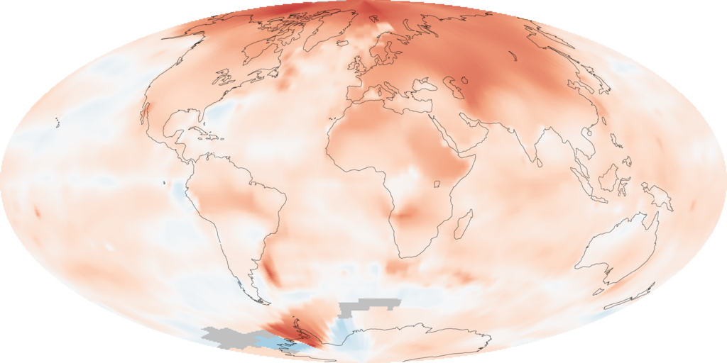
GISS temperature 2000-09 lrg
Författare/Upphovsman:
NASA images by Robert Simmon, based on data from the Goddard Institute for Space Studies.
Kreditera:
NASA Earth Observatory Image of the Day: 2009 Ends Warmest Decade on Record http://earthobservatory.nasa.gov/IOTD/view.php?id=42392
Kort länk:
Källa:
Upplösning:
2880 x 1440 Pixel (558475 Bytes)
Beskrivning:
The map illustrates just how much warmer temperatures were in the decade (2000-2009) compared to average temperatures recorded between 1951 and 1980 (a common reference period for climate studies). The most extreme warming, shown in red, was in the Arctic. Very few areas saw cooler than average temperatures, shown in blue. Gray areas over parts of the Southern Ocean are places where temperatures were not recorded. The analysis, conducted by the Goddard Institute for Space Studies (GISS) in New York City, is based on temperatures recorded at meteorological (weather) stations around the world and satellite data over the oceans.
- For temperature palette, see GISS temperature palette.svg.
Licens:
Public domain
Mer information om licensen för bilden finns här. Senaste uppdateringen: Sat, 23 Dec 2023 23:14:50 GMT
