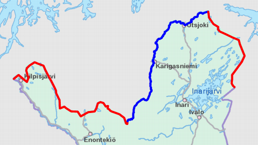
Finland-Norway border map
(c) contains map data from the National Land Survey of Finland Topographic Database 09/2012, NLS open data 1.0
Författare/Upphovsman:
National Land Survey of Finland; color highlights added by Jmk
Kort länk:
Källa:
Upplösning:
514 x 290 Pixel (94821 Bytes)
Beskrivning:
Schematic map of the Finland–Norway border. Land border highlighted in red and river border in blue.
Map cropped from the 1:4000000 background map provided by the NLS of Finland. Highlighted border is based on free numeric data provided by the NLS.
Licens:
Licensvillkor:
National Land Survey open data licence - version 1.0
Mer information om licensen för bilden finns här. Senaste uppdateringen: Mon, 05 Aug 2024 21:59:30 GMT
