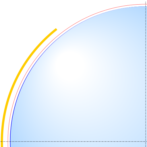
Earth oblateness to scale
Författare/Upphovsman:
Tillskrivning:
Bilden är taggad "Attribution Required" men ingen tillskrivningsinformation lämnades. Attributionsparametern utelämnades troligen när MediaWiki-mallen användes för CC-BY-licenserna. Författare och upphovsmän hittar ett exempel för korrekt användning av mallarna här.
Kreditera:
Eget arbete
Kort länk:
Källa:
Upplösning:
512 x 512 Pixel (1956 Bytes)
Beskrivning:
Scale drawing of the oblateness of the 2003 IERS reference ellipsoid. The outer edge of the dark blue line is an ellipse with the same eccentricity as that of the Earth, with North at the top. For comparison, the outer edge of the light blue area is a circle of diameter equal to the minor axis (a point on the equator, to its antipode). The red line denotes the Karman line (100 km altitude) and the yellow area, the range of the International Space Station (330-435 km altitude, 51.65-degree orbital inclination).
Licens:
Licensvillkor:
Creative Commons Attribution-Share Alike 3.0
Mer information om licensen för bilden finns här. Senaste uppdateringen: Wed, 09 Oct 2024 21:49:16 GMT
