Cuban crisis map missile range
Författare/Upphovsman:
CIA
Kreditera:
The John F. Kennedy Presidential Library and Museum, Boston. [1]
![[1]](http://www.jfklibrary.org/jfkl/cmc/cmc_map_missile_range.jpg)
Kort länk:
Källa:
Upplösning:
666 x 662 Pixel (202362 Bytes)
Beskrivning:
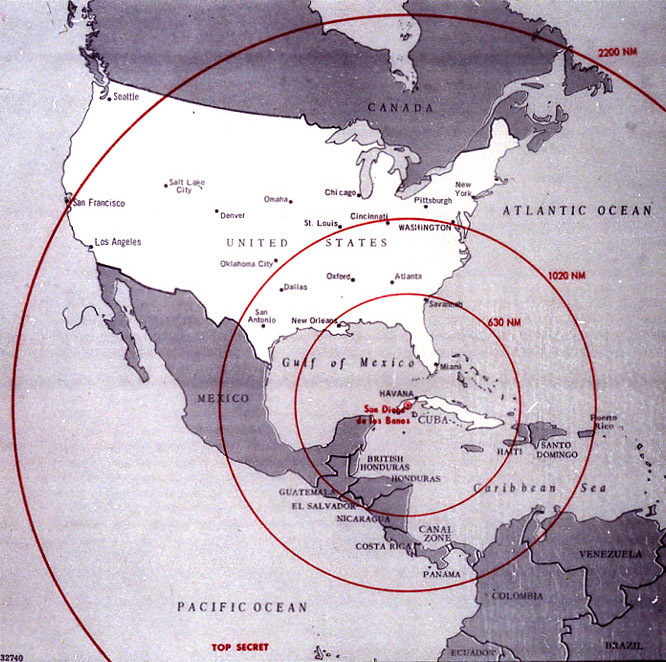
Map of Northern America showing the full range of the nuclear missiles under construction in Cuba, used during the secret meetings on the Cuban crisis.
Licens:
Public domain
Licenskommentaren:
| This image is a work of a Central Intelligence Agency employee, taken or made as part of that person's official duties. As a Work of the United States Government, this image or media is in the public domain in the United States.
|

|
Mer information om licensen för bilden finns här. Senaste uppdateringen: Sat, 31 Aug 2024 23:54:09 GMT