Canada provinces 1905-1912
Författare/Upphovsman:
Ingen maskinläsbar skapare angavs. Golbez antaget (baserat på upphovsrättsanspråk).
Tillskrivning:
Bilden är taggad "Attribution Required" men ingen tillskrivningsinformation lämnades. Attributionsparametern utelämnades troligen när MediaWiki-mallen användes för CC-BY-licenserna. Författare och upphovsmän hittar ett exempel för korrekt användning av mallarna här.
Kreditera:
Ingen maskinläsbar källa angavs. Eget arbete antaget (baserat på upphovsrättsanspråk).
Kort länk:
Källa:
Upplösning:
1000 x 864 Pixel (64189 Bytes)
Beskrivning:
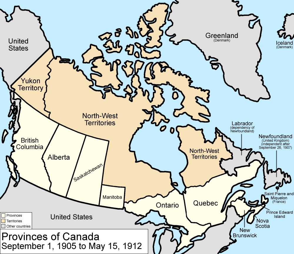
Map of the provinces and territories of Canada as they were between 1905 and 1912. On September 1 1905, Alberta and Saskatchewan were created from parts of the North-West Territories and the District of Keewatin; the remainder of the District of Keewatin was remerged into the North-West Territories. On May 15 1912, parts of the North-West Territories were given to Manitoba, Ontario, and Quebec. Also note that in 1912, the official name dropped the hyphen, changing to "Northwest Territories".
Made by User:Golbez.
Licens:
Licensvillkor:
Creative Commons Attribution 2.5
Mer information om licensen för bilden finns här. Senaste uppdateringen: Thu, 11 Jul 2024 04:14:17 GMT