CaminoRealAdentro
Författare/Upphovsman:
U.S. National Park Service
Kreditera:
Kort länk:
Källa:
Upplösning:
698 x 682 Pixel (382740 Bytes)
Beskrivning:
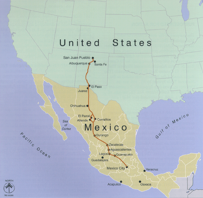
Map of Camino Real de Adentro of the Spanish Viceroyalty of New Spain:
- Trail route runs between Mexico City in Colonial Mexico, and Santa Fe and San Juan in Colonial New Mexico (Santa Fe De Nuevo México province).
- Present day nations/borders are shown.
Licens:
Public domain
Mer information om licensen för bilden finns här. Senaste uppdateringen: Tue, 13 Sep 2022 03:35:58 GMT