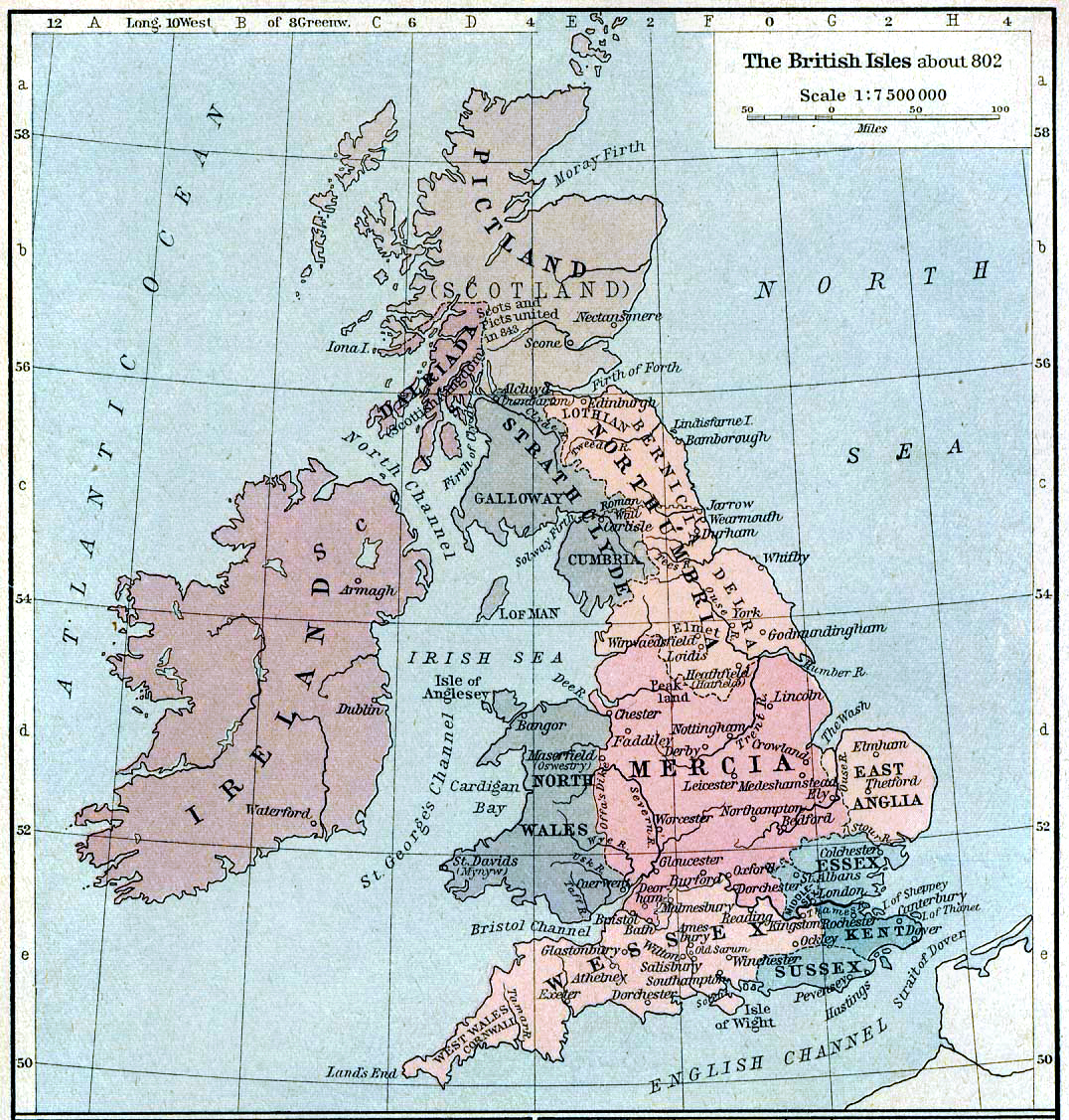
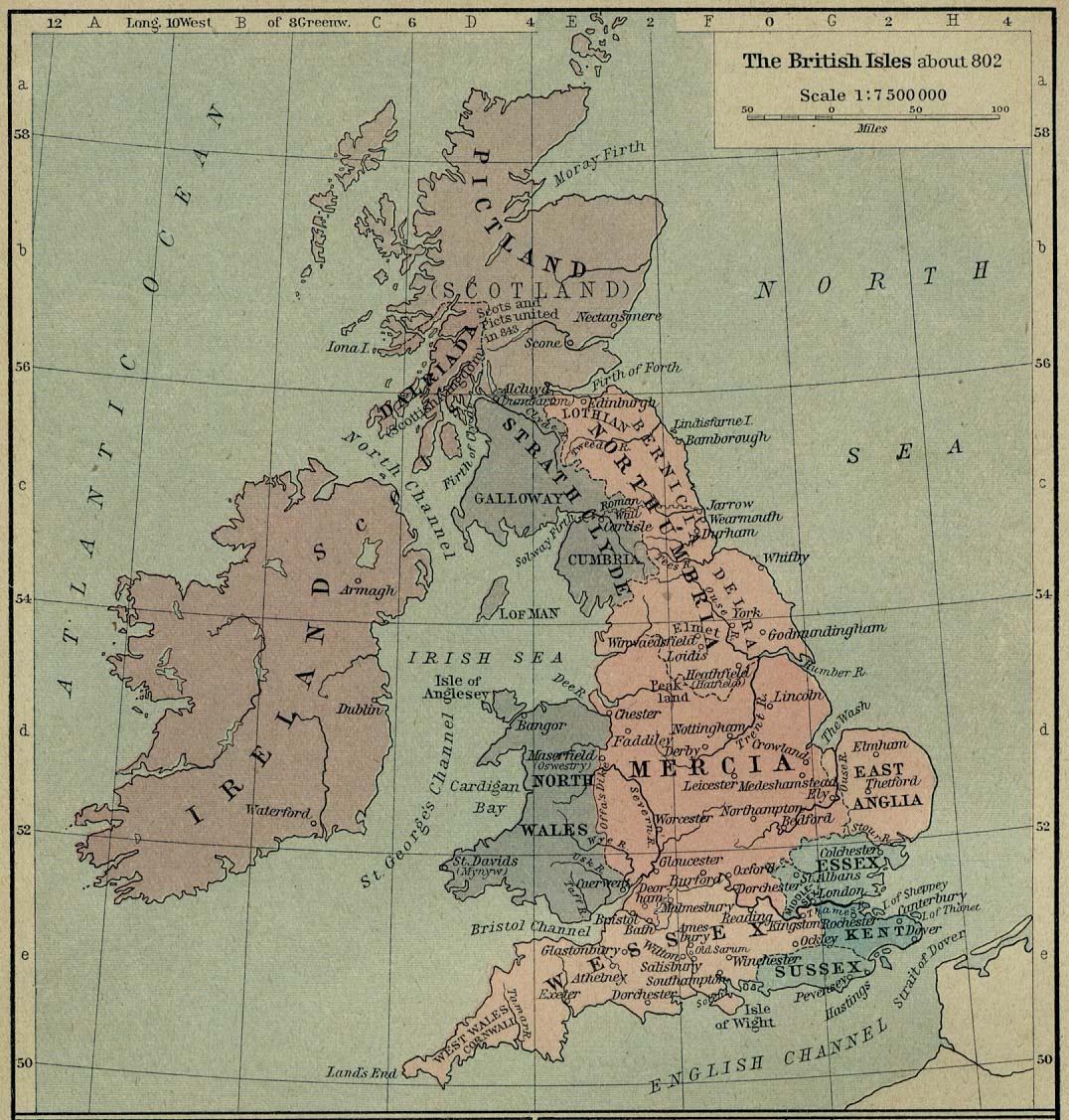
British isles 802
Författare/Upphovsman:
Kreditera:
Shepherd, William R. (1926) Historical Atlas, Category:New York: Henry Holt and Company
Kort länk:
Källa:
Upplösning:
1076 x 1127 Pixel (1356236 Bytes)
Beskrivning:
Map of the British Isles claiming to represent borders circa 802 AD.
Licens:
Public domain
Mer information om licensen för bilden finns här. Senaste uppdateringen: Wed, 08 Jan 2025 18:07:08 GMT