BlueLine
Författare/Upphovsman:
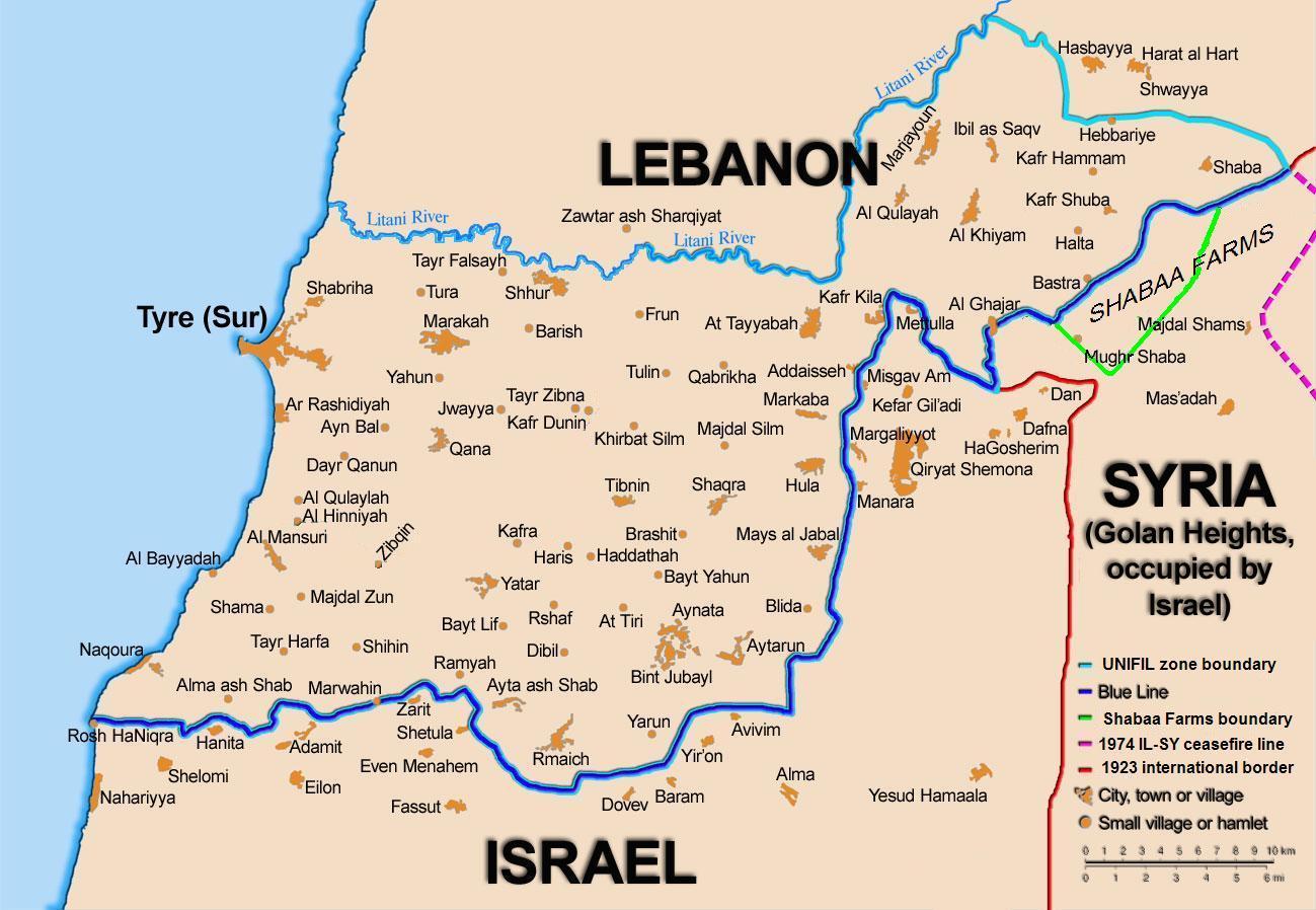
99of9 / * The map is made by Thomas Blomberg using the UNIFIL map, deployment as of July 2006 as source.
Tillskrivning:
Bilden är taggad "Attribution Required" men ingen tillskrivningsinformation lämnades. Attributionsparametern utelämnades troligen när MediaWiki-mallen användes för CC-BY-licenserna. Författare och upphovsmän hittar ett exempel för korrekt användning av mallarna här.
Kreditera:
Self-published work by 99of9
Kort länk:
Källa:
Upplösning:
1299 x 898 Pixel (161102 Bytes)
Beskrivning:
Map showing the Blue Line demarcation line between Lebanon and Israel, established by the UN after the Israeli withdrawal from southern Lebanon after its short 1978 invasion called Operation Litani. It follows the 1949 cease-fire line, also known as the Green Line, as well as the somewhat contested Lebanese-Syrian border towards the Israeli-occupied Golan Heights.
Licens:
Licensvillkor:
Creative Commons Attribution-Share Alike 2.5
Mer information om licensen för bilden finns här. Senaste uppdateringen: Mon, 23 Sep 2024 12:41:03 GMT