Alemannic-Dialects-Map-English
Författare/Upphovsman:
- Alemannic-Dialects-Map-English.svg: *Alemannic-Dialects-Map-German.svg: *Alemannic_language_location_map_in_1950-de.svg: *derivative work: Pyrokrat (talk)
- Alemannic_language_location_map_in_1950-fr.svg: Sémhur
- derivative work: Testtube (talk)
- derivative work: Testtube (talk)
Tillskrivning:
Bilden är taggad "Attribution Required" men ingen tillskrivningsinformation lämnades. Attributionsparametern utelämnades troligen när MediaWiki-mallen användes för CC-BY-licenserna. Författare och upphovsmän hittar ett exempel för korrekt användning av mallarna här.
Kreditera:
Kort länk:
Källa:
Upplösning:
1400 x 1000 Pixel (858416 Bytes)
Beskrivning:
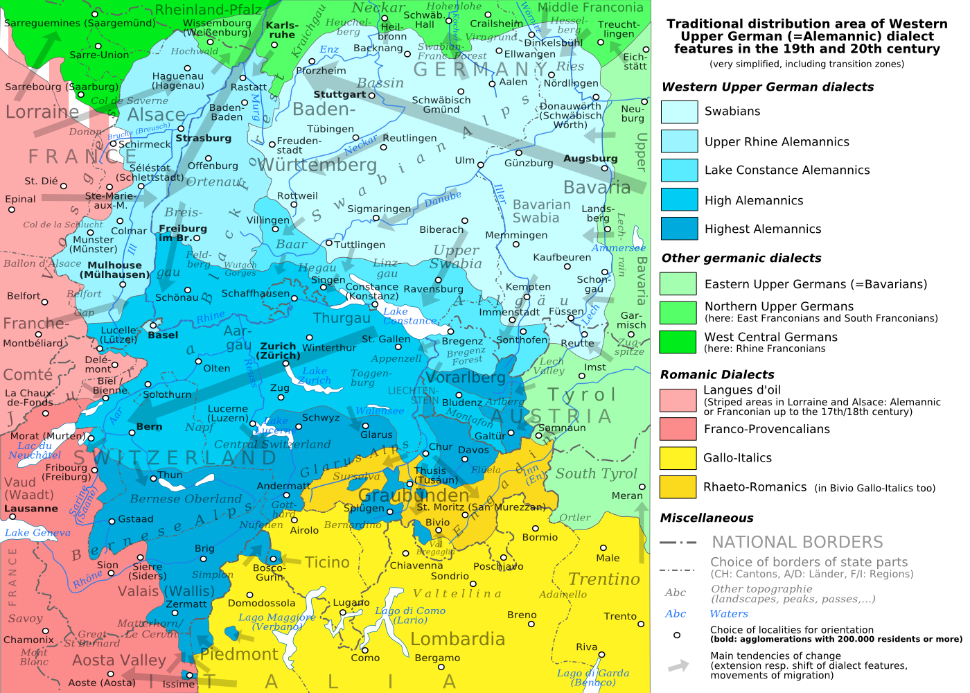
The traditional distribution area of the western upper German (=alemannic) dialects in the 19th and 20th century. Source: Mainly these articles in the German wikipedia: * Alemannische Dialekte * Grenzorte des alemannischen Dialektraums * Traditionell rätoromanischsprachiges Gebiet Graubündens and * Sprachen und Dialekte in der Region Elsass, plus the (newer) literature, which is mentioned there. This area, having been quite stable for at least some 300 years up to the 19th century, saw consecutively more or less strong changes by industrialisation, population growth, migrations and political developments.
Licens:
Licensvillkor:
Creative Commons Attribution-Share Alike 3.0
Mer information om licensen för bilden finns här. Senaste uppdateringen: Sat, 09 Mar 2024 21:47:15 GMT