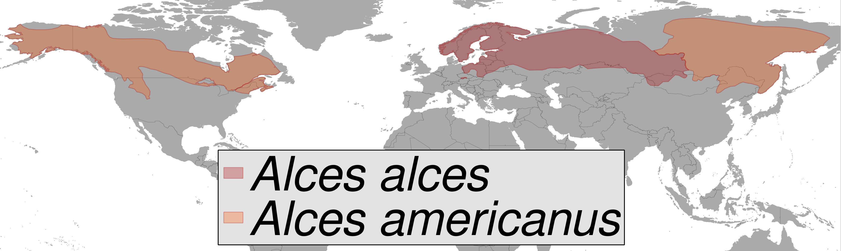
Alces sp. distribution (gray)
Författare/Upphovsman:
- compiled by rbrausse with Quantum GIS
- Map data: Made with Natural Earth. Free vector and raster map data @ naturalearthdata.com.
- Range data:
- Henttonen, H., Stubbe, M., Maran, T. & Tikhonov A. 2008. Alces alces. In: IUCN 2012. IUCN Red List of Threatened Species. Version 2012.2. <www.iucnredlist.org>. Downloaded on 15 November 2012.
- Geist, V., Ferguson, M. & Rachlow, J. 2008. Alces americanus. In: IUCN 2012. IUCN Red List of Threatened Species. Version 2012.2. <www.iucnredlist.org>. Downloaded on 15 November 2012.
Kreditera:
own work, based on http://www.naturalearthdata.com/downloads/ (downloaded Oct. 2012) and https://s3-eu-west-1.amazonaws.com/spatial-data/groups/MAMMTERR.zip
Kort länk:
Källa:
.png?uselang=sv)
Upplösning:
3543 x 1057 Pixel (572207 Bytes)
Beskrivning:
geographic distribution of Alces alces and Alces americanus
Licens:
Licenskommentaren:
The use of spatial data from the IUCN Red List web site to produce species distribution maps is subject to the Attribution-Share Alike Creative Commons License. In short: you are free to distribute and modify the file as long as you attribute its authors and the IUCN Red List.
Licensvillkor:
Creative Commons Attribution-Share Alike 3.0
Mer information om licensen för bilden finns här. Senaste uppdateringen: Thu, 26 Sep 2024 08:45:02 GMT