2008 09L 5-day track
Författare/Upphovsman:
NHC/NOAA
Kort länk:
Källa:
Upplösning:
895 x 716 Pixel (37748 Bytes)
Beskrivning:
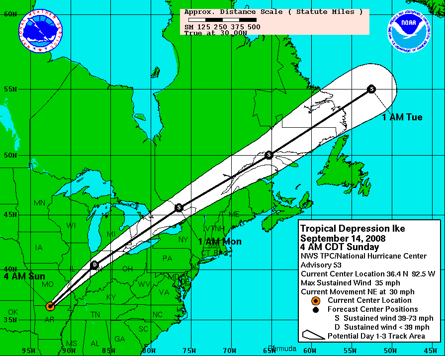
Hurricane Ike 5-day tracking map from NHC. The mileage ruler is in statute miles, where 5 degrees of latitude span 345.2 miles (555.8 km),[1][2] and 5 degrees of longitude at 30 degrees North latitude span 299.8 miles (482.7 km).[3]
The scale and offset of the map can vary with each advisory (compare map boundaries of advisories 43 & 44), re-centered for the latest forecast path (white cone).
Licens:
Public domain
Mer information om licensen för bilden finns här. Senaste uppdateringen: Sun, 24 Sep 2023 13:29:40 GMT