Map sagegrouse range2000
Författare/Upphovsman:
M. Schroeder
Kreditera:
Kort länk:
Källa:
Upplösning:
720 x 540 Pixel (63382 Bytes)
Beskrivning:
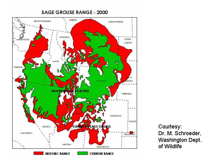
Range map of the Greater Sage Grouse (Centrocercus urophasianus) — historical (red) and present day (green) in western North America.
- By the U.S. Fish and Wildlife Service (2000).
Licens:
Public domain
Mer information om licensen för bilden finns här. Senaste uppdateringen: Mon, 02 Sep 2024 14:44:57 GMT